Showing posts with label Lake Superior. Show all posts

04 November 2017

Schreiber in June 1993 & Van Horne Writes re: an "Inspired Idiot"


This post centres on Schreiber and Lake Superior and also features some of Van Horne's correspondence about the line along the lake.

Casting about for a series of photos which had definitely never seen the light of day, I found some. 

By June 1993 my job was getting stressful enough that I gave up my ailing hand-fired Yashica in favour of an automatic point and shoot - as my spouse just reminded me - "so that my whole vacation [wouldn't] be spent thinking about photography!!".

... Well, I hope I had a good vacation.

*  *  *

The view below, from Schreiber's east, was probably taken during the mid-1970s (a guess).


from: Geology and Scenery, North Shore of Lake Superior; EG Pye; 1969; Ontario Department of Mines.

We'll be travelling from west to east for this post and the photo below was taken near Dublin with the nearest Lake Superior feature being Mozakama ('Kama') Bay. We are looking timetable west toward the Red Rock and Nipigon area. You can get a very similar (better!) image using Google maps in 2017, but on the internet my 1993 photos would probably be given the prestigious 'vintage' label.

As we pass the map of the area's geology, above, you might note that probably the most challenging running occurs over the purple area - the 'Coldwell alkaline complex' - including the ruling grades in both directions for the Heron Bay subdivision.


Near Dublin - The small plastic fisheye lens darkens the edges of the photos.


Above is my 'big' contribution to Schreiber's local oral history.

During the first few months of 1977, I remember seeing uniformed train crew members (as opposed to engine crew) from The Canadian trudging through the snow to this hotel. The hotel above can be seen to the right of the 'barn shaped' roof of the old arena in the postcard above.

Passenger train crew worked over multiple subdivisions while all engine crews covered one ... as the nature of their duties was quite different. Because Schreiber was the 'home' terminal for most of us, the company didn't maintain a bunkhouse here as it did at our objective terminals at White River and Thunder Bay. So this hotel was the company-designated rest location for just a few employees.

Between 1909 and 1967, a 110 bed ('railroad') YMCA provided accommodation for itinerant railroaders (and other travellers) in Schreiber ... and similar YMCAs performed this function at many other division points across Canada.

After the end of steam, as new technologies displaced workers in many traditional trades and professions, there was less need to house workers from out of town at every division point. The evolution of collective agreements between the company and running trades employees led to standardized company-maintained private room accommodation in special modular buildings at objective terminals.

At Schreiber in the late 1970s, bumped (lower seniority) running trades employees (eg. from Thunder Bay) ... and out of town trainees 'coming on brake' found our own motel rooms from within the local inventory. With an ongoing mill expansion at Terrace Bay, it was a seller's market and weekly rates were priced accordingly. Overlooking Schreiber's scenic wooded gully, and at the far end of the motel's water pipes, I never, ever had hot water in my $306/week (corrected for inflation to 2017 dollars) room.

While I'm at it, neither did my room have a phone. Consequently I participated in a historic, vanishing railway procedure - being called for duty in person by a yard office caller, instead of by phone. I slept quite well during those days, but then came the dreaded knock on the door in the middle of the night, telling me I was ordered for the Paper Train.

Happily, Rolly solicited me as his upstairs tenant after our first memorable round trip together to White River.


Scotia Street, looking 'west'.

To me, this seems to be Schreiber's traditional main commercial street. A modern argument could be made for the Trans-Canada. Considering the importance of the George Stephen's Bank of Montreal in CPR history, you won't be surprised that the Bank of Montreal had branches near the terminals at Schreiber and White River. The blue bank building is just beyond the former medical centre brick building on the corner.


I blew into town at about the same time in the season as Charlie, above.
The view above looks east.
I think smoke jacks of the roundhouse are visible at the right edge of the photo.


Continuing in June 1993 ...
The yard switchers are getting bigger and bigger.
A little Alco did the work in 1977 and it also powered a quick turn to Terrace Bay.
The wooden caboose on the latter job still used kerosene markers.

The car shop above must be very quiet in 1993.

It's not because the carmen are all out of town with
the Thunder Bay auxiliary at another 'affair'.
They are simply gone from Schreiber.


Engineering buildings west of the station are gone now in 2017.


Here are a few views of Schreiber station in 1993.
The impressive communication wire arms are all gone in 2017.
... as are the dispatchers and the divisional staff from the second floor.

I wonder who kept the shoebox-sized container with all the
tiny skeins of yarn for the trainees' colour sense tests?
What colour is this ... ?

In 1993, you could still fit a piece of plywood in the back of a pickup truck.


The train inspection light is still there.
The lead for Superintendent Small's business car is gone.
The sputtering of a van generator no longer cues the tailend crew to swing aboard.


*  *  *

Moving east from Schreiber.


I think this is Black Fox Lake - to the north of the highway?
There are countless silent and intriguing lakes shaped by glacial action and erosion.


I think this is Ripple Lake living up to its name.
We had stopped for some stock shots of this favourite location
and a westbound was kind enough to pass by.
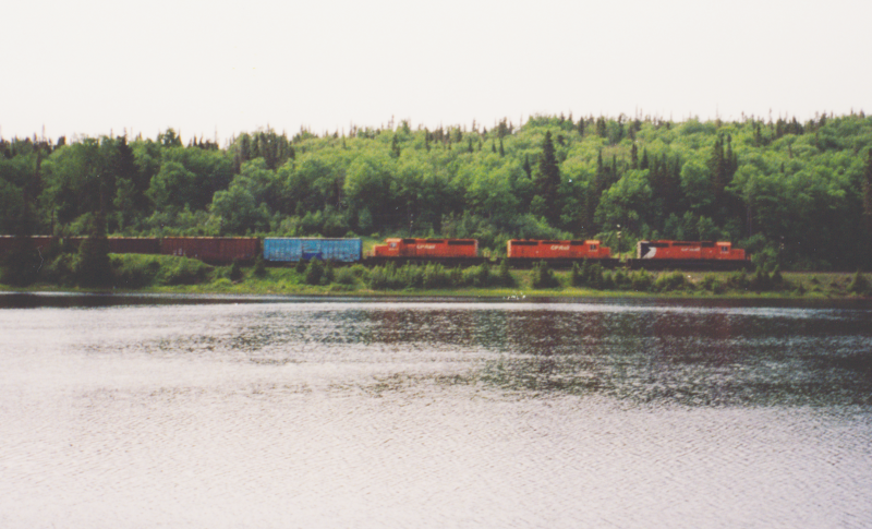


*  *  *


A dramatic location to see an eastbound is at the crossing at the top of the hill at Neys.
After my Ripple Lake luck I can't complain that I can only do a study of the track.

The heavy use of rail anchors prevents the rails from being clawed downhill
under the wheels of eastbound power climbing the ruling grade.

Descending trains complying with the permanent 30 mph slow order
on the high curving bridge over the Little Pic River at the foot of this hill,
will also tug on the rail anchors ...

In the 'old days' eight hot wheel treads on each car grasped at the rails.

Today, probably, 'ideally' from the Company Perspective ...
most of the resisting adhesion occurs only at the locomotive wheel treads
and dissipates through the electrical grids of the dynamic brakes.

... less work for the carmen to worry about.

*  *  *

About a century earlier ...


from: Thunder Bay District 1821-1892, A Collection of Documents; ed:Elizabeth Arthur; 1973; University of Toronto Press.

A substitute for masonry is seen below.
When finances permitted, in keeping with pioneer railway practice,
the gap below was filled by dropping stone from cars stopped on the trestle.

The telegraph poles are artfully canted off the south side of the trestle.
Notice how light the rail is.


Inwood (the address above) is near Petrolia in southern Ontario


from: Thunder Bay District 1821-1892, A Collection of Documents; ed:Elizabeth Arthur; 1973; University of Toronto Press.

... later that year ...

from: Thunder Bay District 1821-1892, A Collection of Documents; ed:Elizabeth Arthur; 1973; University of Toronto Press.
*  *  *

Finally, this modern Oakman postcard can be dated with some precision ...


The Schreiber [railway] Underpass (lower left) opened on September 1, 1965.
I was excited to find a commemorative highball glass from this event
at an antique store we visited somewhere.

Action Red was introduced in 1968 and not a trace of it can be seen in the yard,
or on Number 1's equipment.

As a final bit of historical trivia ...
Above: I think Rolly and Theresa's green roof (surrounded by trees)
can be seen beyond the underpass
and immediately beyond the two low Catholic church buildings.

He purchased it from an engineer by the name of A. McCorkill.
In the 1930s Mr McCorkill may have begun his railway career as a telegrapher.


A further enlargement of the station buildings and yard appears below.


30 May 2015

White River's New Station - 1958


My father saved an article from the CPR Spanner of April 1958 about the new station which had recently been built there. Twenty years later, I would meet one of the workers mentioned in the article.

Until circa 1924, I believe that White River had been the headquarters of the division - that is, where the division superintendent, his administrative staff and the main dispatching office had been. I also believe that physical space limits for more expanded shops and yards, and the periodic flooding of the White River itself, precipitated this change. When I 'came on brake' in Schreiber very briefly in 1977, Schreiber was well-established in its role as the Division Headquarters and it seemed it had always been that way.

from: White River - 100 Years, Pictorial History, 1985, Mary Houston.

My main intention with this post is to pass on and preserve the 1958 article. However, I am including a few other images so readers can understand some of the changes to the station facilities over the years. Mary Houston's wonderful 1985 book - prepared with the help of the people of White River and their photographs - shows the earliest station facilities.


from: White River - 100 Years, Pictorial History, 1985, Mary Houston.

A photograph taken in July 1911 by a CPR civil engineer shows the addition of a second story and of an extended platform and passenger shelter. The Spanner article below adds details about the station's modifications through the years and I have not included all of the station photos in Mary Houston's book. You can imagine Division offices upstairs and dispatchers running a few hundred miles of railway by timetable and through train orders sent by telegraph.


Unused postcard, circa 1955, my collection.

About fifteen years after King George VI and Queen Elizabeth (later, the 'Queen Mother') did a walkabout on White River's platform, a diesel stands ready as a westbound passenger train arrives at the building.


from: Canadian Pacific Railway, Spanner, April 1958, collection of LC Gagnon
The sled on the platform appears in Mary Houston's book.


from: Canadian Pacific Railway, Spanner, April 1958, collection of LC Gagnon

There were only a few eastbound stock cars at the headend of some freights by 1977 and the animals travelled without 'rest' enroute. 

After the running trades, I did a brief internship with Bob Mura on his overnight shifts. He was a great guy and I can imagine him saying with vigour that something was the 'best thing that happened since someone invented the wheel'. A relative of his whom I met on the internet told me that yardmaster Linklater was Bob's father-in law and that the yardmaster's nickname was 'hot cakes'.

On the pegboard behind Bob are 'trains' and cuts of cars. The IBM punch tape representing a given consist, was wrapped around the thumb and pinkie finger to form those 'figure of eight' loops. To 'couple' a local lift, you could run the train tape through an off-line machine, followed by the lift, and have the machine produce a copy in the form of a new one-piece tape. The train tapes were fed through an on-line machine to update the car control folks at the other end of the wire in Montreal.


from: Canadian Pacific Railway, Spanner, April 1958, collection of LC Gagnon


from: Canadian Pacific Railway, Spanner, April 1958, collection of LC Gagnon

I tried, but could not resolve the details of the items within the display cases on the far wall. I think I could see a commemoration of the Royal Tour of 1939, however.


from: Canadian Pacific Railway, Spanner, April 1958, collection of LC Gagnon

Ahem! Mary Houston went to great lengths in her book to prove that this famous thermometer was broken and that the temperature in official records for that day was not quite that cold. 

The 'coldest spot' legend comes from the old days when weather data was sent by telegraph wire and when big city newspapers printed what was available. The modern 'discovery' of the militarily strategic arctic after World War Two cleared up any confusion about the fact that there were colder locations in Canada.


from: Canadian Pacific Railway, Spanner, April 1958, collection of LC Gagnon

In the interest of preserving this piece of history, I 'tuned' the image up as much as I could.

03 March 2015

Summer, Thunder Bay, Canadian Northern


A few photos taken during a summer afternoon at Thunder Bay, 1995.

Thunder Cape from Thunder Bay Harbour


Detail on the Canadian Northern Railway (original builder) Port Arthur station.


Canadian Northern Railway (builder) Port Arthur station, south side.


from: The Boston Transcript, January 2 1902.


Unused postcard circa 1905
The stub end of the track in front of the station is interesting. The Canadian Northern mainline between Winnipeg and Port Arthur (via Fort Frances) was officially opened on January 1, 1902. 

(The Canadian Northern Railway was not granted running rights over the CPR between Port Arthur and Current River until 1910. The section of the Canadian Northern line between Port Arthur and Capreol - via Hornepayne and Oba - was officially opened on January 1, 1914.)


The Canadian Northern's prairie origins and orientation can be observed in the following advertisement from 1905.

from Railway and Shipping World, January 1905


05 December 2014

A Tour of the CPR Heron Bay Sub in 1986, Part 2 of 2

Featuring the Photographs of Eric D. Gagnon
My brother went west by train in 1986. One important project of this trip was to drive the backroads and to document the vanishing wooden country grain elevators in Saskatchewan. In addition, on his way around Lake Superior, he photographed the Heron Bay and Nipigon subs in great detail for me. He spent at least five or six hours shooting out the tailend of The Canadian and recording the location particulars for each photo.

Continuing west, we have departed from Marathon - 'Peninsula' on this 1915 map of telegraph stations. We will be travelling through the most rugged section of the Heron Bay Subdivision - much of it built along the shore of the Lake Superior on solid rock.


The westbound Canadian has travelled down the long grade from White River, to near lake level at Marathon (Peninsula). 

As the following 1973 Haulage Capacity data shows, the ruling grade (underlined) Eastbound is considered to be beyond Middleton, and the ruling grade Westbound is considered to be beyond Marathon.


Variables used for the calculation of equivalent tonnage (the mass to be moved) and haulage capacity (the power available to move the mass) over a subdivision include:
  • tare - the weight of the cars when empty
  • contents - the weight of freight in the cars
  • train resistance - curvature and grades - 20% is 'medium'.
  • temperature - Very cold temperatures increase rolling resistance.
  • for the direction of travel: the lowest grade coefficient on the subdivision, e.g. 1.70
  • tonnage rating of the various units in the locomotive consist
  • reducing the tonnage rating if locomotives have traction motors cut out.
  • state of the rail - dry, wet, frosted, snow-covered - It affects locomotive traction: the power at the rail.

By using the data above, and performing a few calculations using a pencil and paper, yard office staff could balance the haulage capacity of the locomotives (power) with the equivalent tonnage of the train (mass) to ensure that any freight train could be pulled over the subdivision successfully, and without wasting power.

Most of the 'advertised' freights, working on schedules promoted to shippers, used an easier 'horsepower per ton' formula. With the flexibility provided by Centralized Traffic Control (CTC) there was no need to put these schedules in the actual employee timetable.

Looking at the posted train line-up at the Schreiber yard office, Rolly would sometimes view the locomotive numbers and the tonnage listed for a particular train and dismissively state "That's a drag". Most crew members would know when a low priority freight train's power was barely enough to pull the tonnage over the subdivision.

Heron Bay Subdivision from 'west' of Marathon to Red Sucker Tunnel


Near mile 69, Heron Bay Sub
With the morning sun still low on the horizon, The Canadian in 1986 edges along its 100 year old ledge - blasted into the cliffs along Lake Superior.

Near mile 71, Heron Bay Sub.
Rock slide fence 'protects' the track when these wires are broken by rock tumbling down from the cut above. Signals protecting the susceptible zone of track are reset from 'proceed' to an indication warning that the train must be prepared to stop short of an obstruction on the track. In the past, rock watchmen were employed to walk these remote sections of the track on a regular basis, particularly before passenger trains were due.

Red Sucker Tunnel mile 71.6

Heron Bay Subdivision from Mink Tunnel to Neys

Mink Tunnel, Mile 73 Heron Bay Sub
Mink Tunnel in the spring of 1885; from: Van Horne's Road; Omer Lavallee; 1981; Railfare Books
The rock structure containing Mink Tunnel was left as a buttress to the rock formation along which the line had been blasted. This view toward the head of Mink Harbour (and Mink Creek) shows the original type of wooden trestle used to bridge across low areas of new construction. These gaps would eventually be filled by dumping rock from loaded cars positioned on the trestle itself. The idea with Canadian wilderness railways was generally to build a functioning through line first .. then worry about 'improvements' such as 'filling' trestles when more money was available. Trestles might last for a couple of decades before they would need replacement - so they provided a good stop-gap for railway builders during Canada's railway boom.
Mink Tunnel postcard, late 1940s
This gharishly colourized old postcard (I toned it down) shows the results of 60 years of improvements to the line. The trestle has been filled and Mink Creek is no longer naturally emptying into Lake Superior.

Notice the wooden 'telltale' to the left of the track and just outside the tunnel - a statutory warning of an approaching restricted clearance to any crew members working on the car roof walkways. A fringe of knotted ropes dangling from the hangman's assembly was designed to strike and warn the rooftop crew member on a moving train so they could flatten themselves on the roof before the obstruction was reached. Particularly in dense fog or at night these devices had the potential to save lives.

In our picture above, the railway management and train crew have detrained and are watching to see if the photographer will break his neck .. the former are standing at the Mink Tunnel sign. Meanwhile, the lake breezes are blowing back the steam from the popped safety valves on the locomotive as it stands with a hot fire.


Before portable radios became common in the 1970s, switching 'commands' had to be relayed by hand or lantern signal to the engine crew. In a screen cap from the safety training film 'Why Risk Your Life?' on YouTube, a Great Northern crew in the 1940s shows how roof walks were often used during switching operations.

East switch Coldwell, with Echo Lake at the left.
Looking at the switch points, you can see that the dispatcher in Schreiber is putting my brother's train into the siding at Coldwell. For a number of reasons this is my favourite station on the line.

Coldwell siding and back track, mile 74.7
Eastbound freight at Coldwell: Locomotives 6013 5001 4743 at 0715hr.
Running its way down the steep hill from Neys, this freight is twisting and turning its way through Coldwell and its descent will continue until it almost reaches lake level near Mink Tunnel. It is a lot easier to stop and start The Canadian than this guy. The engineer's wave indicates no problems spotted with our train.

Heron Bay Sub, Neys to Ripple
Obsolete railway station names are not published in the employee timetable ... but they are sometimes used because of tradition (e.g. use by older employees) or because they identify an important point on the railway. While 'Ripple' has no remarkable features, 'Neys' represents the crest of a significant grade in both directions.

Bridge over the Little Pic River, mile 81
Ever since railway operations began, the Heron Bay Subdivision has been cursed by this bridge located on a 30 mph curve ... and for eastbounds ... an immediate trip up the ruling grade for the subdivision. My brother is starting to fight the morning sun shining directly into his lens. But I have included this photo to show how abruptly the grade starts. Trains can't take a decent run at the ruling grade.

This was once the location for 'great heroics' by some spareboard headend trainmen (the most junior crew members imaginable). A defective diesel unit on an eastbound might shut itself down - thus reducing the haulage capacity of the locomotive consist - we studied 'power' at the beginning of the post. To help deal with this, the engineer would curse, pray ... and then show the lowly trainman how to take the trailing locomotive off 'isolate', how to restart it, etc. What else would he do with his time? Once brought back to life, the revived unit might only work for part of the way up the hill, but that might be all the help the engineer needed to avoid a stall or doubling his train.

Every time I was asked to do this on an eastbound, it was always necessary to travel along the icy locomotive running boards and over the inadequate lurching steps between the locomotives while travelling over this bridge. As always, the final instructions were "Be careful and hold on!".

Little Pic River Bridge mile 81, Heron Bay Sub.
1985 timetable for the Heron Bay Subdivision


Heron Bay Subdivision, Ripple to Steel
East switch at Steel


Bridge at mile 94.8 Heron Bay Sub over the Steel River
Heron Bay Sub from Steel River to Moberley Bay

East switch Jackfish

Jackfish siding, and back track containing boarding cars. "New Yards"

Jack Fish was a major CPR depot for bituminous coal for locomotives. The coal was brought to the Jackfish harbour from Pennsylvania by lake freighter. The coaling dock to unload ships near mile 99.9 was in service from 1895 until 1948.

This open area above (today's Jackfish at mile 98.2) was known as the New Yards where coal was stored in cars or stockpiled for the winter. This yard was expanded during both World Wars and could hold 600,000 tons at its peak capacity. (information from: A History of Jackfish; Jeanne Marcella; 1989; Terrace Bay Public Library)

Jackfish as seen from Tunnel Bay, looking toward Lake Superior, c1890. The coal dock has not yet been built.
from Van Horne's Road; Omer Lavallee; 1981; Railfare Books

Jackfish Tunnel mile 101.8
Jackfish Tunnel c1950, postcard.
Like the previous Mink Tunnel postcard, the train is stopped, and the photographer has scaled the rocks. This time the telltale is made of steel, probably with a dangling fringe of durable aluminum rods.

The Last Spike Monument at mile 102.7 in 1935 and the crew which built it.
from: A History of Jackfish; Jeanne Marcella; 1989; Terrace Bay Public Library
The cairn reads - all upper case: 
Driving the Last Spike 
between 
Montreal & Winnipeg 
May 16th 1885 
was re-enacted here 
by veterans and some 
original participants 
May 16th 1935.

Lavallee goes into greater detail if you are interested.


Mile 103.7 Heron Bay Sub
As we follow along, the headend of the Canadian is starting its way around Moberley Bay. At Moberley Bay in the late 1970s - even on the coldest winter day - the cab became full of the choking sulphurous stench from the waste being poured into the Lake Superior from the Terrace Bay plant. 

The bay provided an attractive view of long freight trains during the era of vans (cabooses) as the headend and tailend crews could usually see each other across the bay ... moving in opposite directions. I remember an engineer of the PAT train walking across the cab to admire his train early on a beautiful sunny morning. The salutation "OK around the bay, Extra xxxx west!" was usually made at this point by the headend. 

Heron Bay Sub, Moberley Bay to Terrace Bay.

Terrace Bay station and yard.
The sun is causing my brother grief, but you can see the raised TERRACE BAY lettering on the lower level of the station building.

Black River bridge mile 110.5
The Terrace Bay station is still in sight beyond the extra-tall absolute signal.

East switch Schreiber. Home again.


In 1939, King George VI and Queen Elizabeth (later the 'Queen Mother') crossed Canada by rail and also visited the US and Newfoundland to rally support for the coming conflict in Europe. This ring-bound book contained standard CPR and CNR public relations photos and descriptions for souvenir presentation to key participants and also for press use.

While the Heron Bay subdivision sees intermodal, crude oil and grain traffic today, it has played many different roles in its past history.

For the record, the Royal Train was scheduled to be in Schreiber 1325-1335hr Tuesday, May 23 - just enough time for a crew change and a brake test. You can find photos showing that there were royal walkabouts at both White River and Schreiber.