
Leaving our 'base' in Portage la Prairie -
staffed by my eternally patient and supportive aunt and uncle -
we ventured out ... to the west and south.
Below:
Look! There's that slogan being used in government advertising.
It's in the present tense!
 |
| Commercial Canada, Its Progress and Opportunities; ed: Fred Cook; circa 1920; Redman Book Co, Leeds, England. |

Westbound at Austin is probably our 'old friend',
the coal empties from the Ontario Hydro unit train.

Today, the train includes an end cupola van.
The train has taken its signal, but notice the clear signal to its left ...
This is that interesting stretch of double track between Austin and Sidney.
The train has taken its signal, but notice the clear signal to its left ...
This is that interesting stretch of double track between Austin and Sidney.

Like Snowflake, Crystal City and Saltcoats,
Red Jacket is a location I was drawn to see because of its name.

Safely zoomed in from the passenger seat,
I snapped this eastbound between Red Jacket and Whitewood.

A Company employee trackside may be wondering why anyone would care to photograph Grenfell.
I think we left the CPR main line
from Grenfell to Indian Head
to take in the Qu'Appelle Valley.
It was highly recommended by our kind sponsors back at Portage.
A circa 1980 map, which includes the rail lines in grey, appears below.
 |
| Atlas of Canada; Henry W Castner; 1981; Reader's Digest/CAA. |
As you know, Saskatchewan is a pretty easy province to draw - almost a perfect rectangle. However, in order to provide the prairie settlers with square, uniform land Sections as the lines of longitude converged, they needed to include ziggity survey lines like you see on the eastern boundary of Saskatchewan - these are Correction Lines.
Sometimes if you drive along north-south axis in flat territory, the road will execute two non-terrain-related 90 degree turns as you follow some ancient surveyor's work on the trackless prairie.
... One quick reference I checked says a one mile east-west 'correction' generally occurred after each 24 mile run of north-south surveying.
If you are a student of all human history, i.e. before European settlement, you may be interested in the size of, and nomenclature used for, the pink First Nations Reserves, above, and on the circa 1900 map which appears at the end of this post.
Now, here are some views of the Qu'Appelle Valley ...


For scale, in the centre of the photo above,
I think you can see a large prairie-style tractor on the near side of that harvested field.
It is visible just above the line of trees.

Approaching Indian Head from the north, I hit the brakes as we spotted a round barn. This was built as part of a large corporate farm established just before the CPR line arrived ...
Early agricultural efforts on the prairies often met with failure
due to drought, early frosts, crop parasites - and more generally -
cultivars and practices which were not adapted to the prairie environment.
This large farm eventually failed before the turn of Canada's Century.
However, to find solutions to the problems listed above,
the Indian Head Experimental Farm was established by the federal government in 1886.
An interesting book about this farm and its crucial work is available at archive.org,
the link is below ...
Indian Head Experimental Farm 1886-1986

Above and below are views of Indian Head.
Below, the main track switch and the original station appear on the extreme right (south side).
A nice assortment of early grain elevator types is shown as well.
 |
| Unused postcard circa 1900. |

Above, we approach Regina from the east.

After visiting the RCMP Depot Museum in the evening,
we stopped by the Legislative Building at around 21hr.
Notice the stone repair and cleaning work in progress.
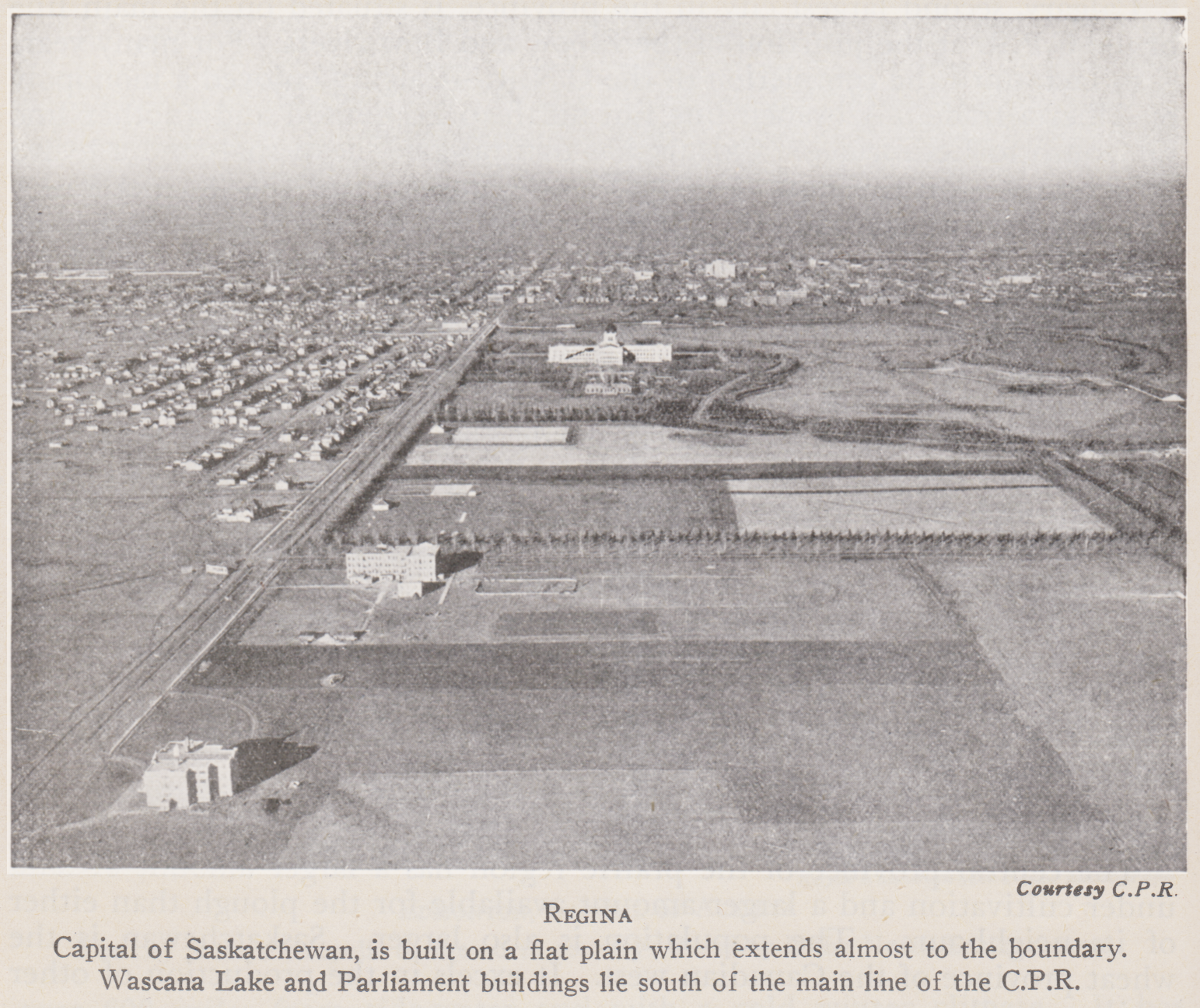 |
| A World Geography for Canadian Schools; Denton & Lord; 1942; JM Dent. |
In a circa 1930s photo, the Legislative Building dominates the skyline - the camera is facing north.
The downtown area can be seen on the far side of Wascana Lake.
Today's Albert Street is the thoroughfare running north, past the west side of the Legislature.
The CPR main line crosses the downtown area obliquely, heading roughly west south west.
 |
| from: unknown atlas published circa 1900. |
The map above had been removed from a 1905? atlas and was sold to me at an antique store. The area to the south and west of Regina had yet to be cluttered with the settlements and rail lines we had come here to see in 1989.
If you are interested in the areas marked I.R. 'Indian Reserve' for their historic significance, you may also be interested in checking into the reason for that government telegraph line to Wood Mountain - another fascinating bit of Canadian history.
And be sure to give yourself extra points if you noticed the Correction Lines and the fair and square surveying of the prairie lands which were in the process of being put under the plows of the settlers.


