In the fall of 1979, during my first vacation from work, I travelled from Montreal to Vancouver and return on VIA. The northern CNR route was taken westbound, with about 24 hours layover in Vancouver. Then the return to Montreal was made by the CPR route. These photographs were taken with a manual Yashica SLR using a stock lens and probably 200 ASA 35mm film.
Using a hand-held time exposure, I share the Winnipeg platform with the flagman.
The marker lamp is lit.
The next morning we are moving very fast as we approach Saskatoon.
The diesel exhaust appears as a smudge to the right of the track.
The ties are covered with frost and the windchill helped work up an appetite for breakfast in the dining car.
The marker is extinguished by day.
Moving through Zelma.
Shutter speed is probably 1/1000 sec.
A potash mine near Saskatoon.
Before VIA took over, the CNR had relocated its operations away from the downtown area.
The main line skirts the southern edge of town and the station is south-west of Saskatoon.
The headend at Saskatoon.
You can see some CN units just beyond our power.
The Super Continental at Saskatoon.
 |
| CNR public timetable, effective April 30, 1944. |
The public timetable map shows the former GTP main line route taken for most of the Portage la Prairie to Saskatoon segment.
 |
| Hammond's Handy Atlas of the World, with new Census; 1912; CS Hammond and Company, New York. |
The real world is better represented in this map, with its inclusion of the latest data from the 1911 Canadian census. The Grand Trunk Pacific practice of naming stations alphabetically in some sections can be seen if you work your way east from Zelma. All lines represent railways and those with side-hatching are proposed railway lines.
 |
| CNR public timetable, effective April 30, 1944. |
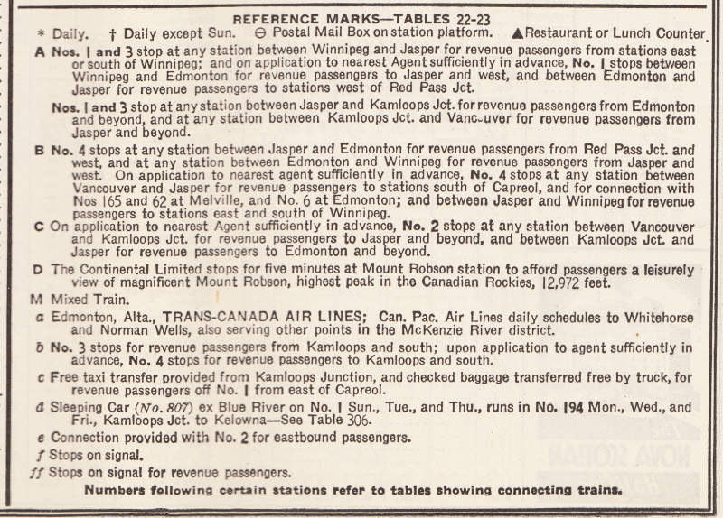
The wartime public timetable above shows the main line passenger traffic at Saskatoon in 1944 and the reference marks are included below.
 |
| CNR public timetable, effective April 30, 1944. |


