Showing posts with label Northern Pacific Railway. Show all posts

11 March 2023

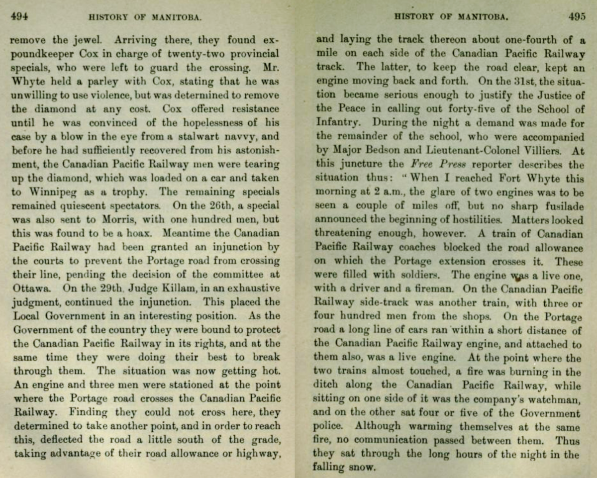
Portage la Prairie Lines, Part 3 - The Battle of Fort Whyte, 1888


Ditching locomotives and using a live steam hose from a locomotive to threaten opponents. 
In Canada's wild west, the CPR was not going to make it easy for opponents to undermine its Manitoba business plan.

But would a duopoly which depended on a small network of foreign branch lines provide the rate relief which Manitoba farmers were after?


First, here is Hanna's account of events ...


The crossing at Headingly (below) comes up more than once in secondary historical sources of these events. This may have been an early flashpoint in the effort to create a competitor for the CPR. It is possible that some secondary writers were unaware of the local geography, but this should not have been the case for Hanna. 


Oh. Well ... Emerson is on the east side of the Red River. 
The CPR line crossing at Headingly goes west to Souris.
Perhaps Hanna didn't know/remember the local geography as well as one would expect!

*  *  *

Who was William Whyte?
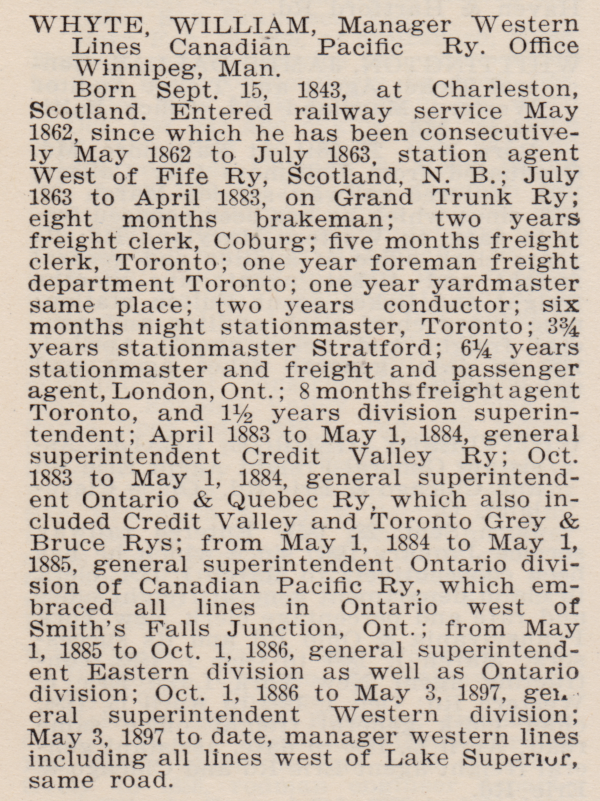
from: Biographical Directory of Railway Officials of America; T Addison Busby; 1901; Railway Age. EDG

*  *  *

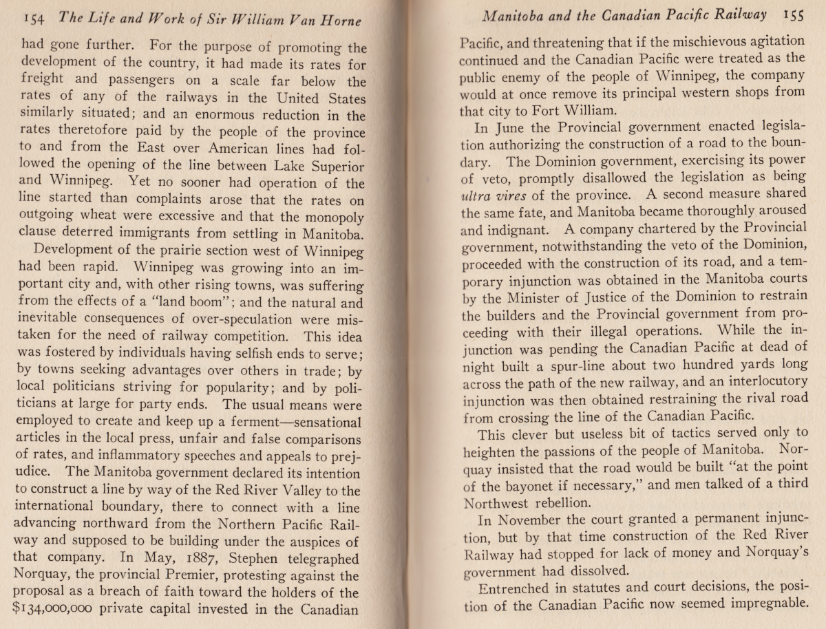
The CPR monopoly and events leading to the Battle of Fort Whyte according to Van Horne from: 


The Branch to Pembina (top, P 157) is consistent with an account below.
We'd expect the CPR to have a corporate memory of where the incident took place.


*  *  *

A more contemporary account by a local author from 1890,
with some local Portage la Prairie history as a bonus.

archive.org


The Manitoba South Western Colonization Railway Co (CPR)
amalgamated with the Souris and Rocky Mountain Railway Co in 1880. 
It went through Headingly (1885).

The Pembina Mountain Branch (CPR) went south from St James,
 and west from Rosenfeld (1882) through Winkler and Pilot Mound.


from: archive.org

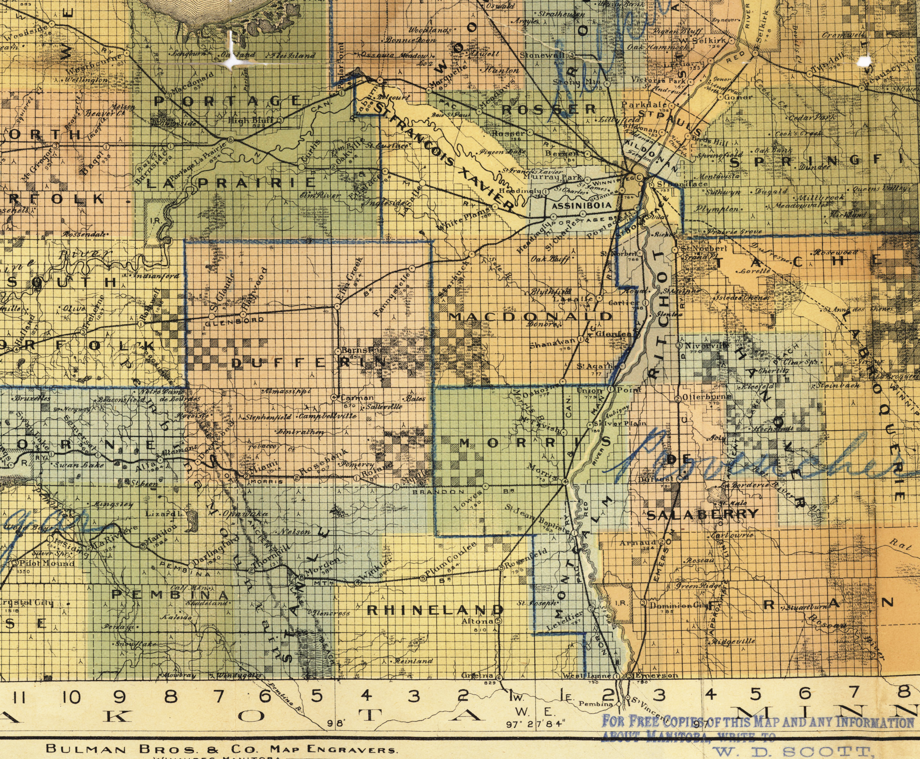
Here is a beautiful map:

Bulman Bros Map of Manitoba by Authority of the Provincial Government Winnipeg, April, 1897.
From: https://www.flickr.com/people/manitobamaps/

*  *  *

Headingly or Fort Whyte?

from: Manitoba's Railways, George A Moore; Canadian Rail July 1975; Canadian Railroad Historical Assn.


If you follow the CPR branch all the way south and west from St James
you'll see by its label (on the large map) that it was the Pembina branch 
which was being crossed in the Canadian Rail article paragraphs above.

(One thing which confused me was the mention in the Canadian Rail article of the 
'Southwestern & Pembina Mountain Branch'. I think they were two separate branches 
and - heading west from NP&M's Portage Jct - the Pembina Mountain Branch would be crossed first.)

Portage Junction (NP&M) is shown to the right of the white star.
If the 'offending' line was being built westward from Winnipeg, 
the first confrontation of the NP&M with the CPR would occur at the white star.

A modern map from the Canadian Rail follows below.

*  *  *

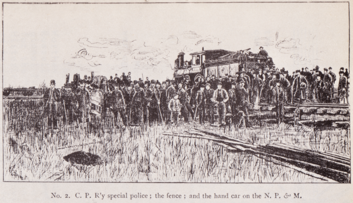
Here are some images and more elaboration on the confrontation.

from: Newsletter from 2001.  https://www.fortwhyte.org/


from: Manitoba's Railways, George A Moore; Canadian Rail July 1975; Canadian Railroad Historical Assn.

from: Manitoba's Railways, George A Moore; Canadian Rail July 1975; Canadian Railroad Historical Assn.

from: Manitoba's Railways, George A Moore; Canadian Rail July 1975; Canadian Railroad Historical Assn.

from: Manitoba's Railways, George A Moore; Canadian Rail July 1975; Canadian Railroad Historical Assn.

*  *  *

The Various Locations of the 'Fort Whyte' ...

from: Manitoba's Railways, George A Moore; Canadian Rail July 1975; Canadian Railroad Historical Assn.


from: Altitudes in the Dominion of Canada; James White FRGS; 1901; Geological Survey of Canada. 

And here is the South Western Branch through Headingly with no Fort Whyte.
from: Altitudes in the Dominion of Canada; James White FRGS; 1901; Geological Survey of Canada. 


from: Place-Names of Manitoba; 1933; Geographic Board of Canada. archive.org


CPR employee timetable.


*  *  *

Railway legislation related to this story:


from: A Statutory History of Railways in Canada 1836-1986; Dorman/Stoltz; 1987; Canadian Institute of Guided Ground Transport.


* * *

Was a Satisfactory Outcome Achieved?


from: The Brandon Weekly Mail, October 1889. archive.org


*  *  *

The Northern Pacific Lines in 1901

from: Altitudes in the Dominion of Canada; James White FRGS; 1901; Geological Survey of Canada. 

from: Altitudes in the Dominion of Canada; James White FRGS; 1901; Geological Survey of Canada. 

From: The Colonist; May 1897; JA Carman. archive.org

*  *  *

So, after the CPR, the Northern Pacific became the second railway to give Portage la Prairie an eastern rail outlet.

We can probably trust the CPR corporate memory that the location of Fort Whyte was south of St James and not at Headingly. 

It seems possible that something happened at Headingly and that some of the non-CPR versions of events are trying to refer to it. 

... 


02 November 2019

1927 Railroad Advertisements from the National Geographic, Part 2


Trigger warning if you're susceptible!: The last ad refers to a 1927 $400 million carbon tax!

Railways and railway-related ads were common in these National Geographic ads - near the end of the Roaring Twenties. 

Additional posts from this series can be found at the bottom of the Short Subjects Index page.


US $1000 in 1927 equals about US $14,000 in 2019


*  *  *

The Milwaukee Road paid for a two-page spread! ...


*  *  *

Below: See and get German things! ...

Hitler was just out of jail, but then he earned himself
a public speaking ban in Bavaria until 1927 ...

Both volumes of Mein Kampf were available and selling briskly by 1927.

... In the 1930s these became 'Must Have!' but seldom-read gifts for
newlywed couples in Germany - making the author independently wealthy.


'Quaint Costumes' - some with armbands.

*  *  *

And a couple more which you might find interesting ...


*  *  *

Below: Sleeve valves were an interesting technology - with some later aviation connections.
However, just like early poppet valves, they had their own shortcomings.

The same company (Willys) later produced one version of the famous WW2 vehicle
which became known as the 'Jeep'.


After posting, Jim Christie provided this link to a contemporary textbook 
to show exactly how these sleeve valves worked:


03 February 2018

Switchbacks and Tunnels in the Cascade Range


Civil engineers used switchbacks to lift some main line routes over mountains as the time-consuming process of constructing tunnels was completed.

The book below is available at archive.org . While researching some aspects of Great Northern construction in the Cascades, it occured to me to check my own copy. In fact, a diagram showed the first Cascade Tunnel and the GN switchbacks. 

I have also included the author's professional perspectives on the construction of tunnels and switchbacks.


The Northern Pacific Railway opened its Stampede Tunnel in the Cascades in 1888.

The Great Northern Railway completed its first Cascade Tunnel through the Cascade Mountains in 1900. 
Its second Cascade Tunnel opened in 1929.

The Chicago, Milwaukee, St. Paul and Pacific Railroad built its line through the Cascades at Snoqualmie Pass in 1909. 
Also known as 'The Milwaukee Road', its Snoqualmie Tunnel was completed in 1914.

Both the second Cascade Tunnel and the Stampede Tunnel are in operation in 2018.
The Snoqualmie Tunnel forms part of a recreational trail.


Until their tunnels were complete ...

The Northern Pacific used switchbacks from June 1887 until May 1888.
The Great Northern used switchbacks from 1892 until 1900.


On the circa 1912 map below: 
Seattle, Washington is near the north-west corner.

Starting at the north edge of the map, and working south, you have:
Cascade Summit - Great Northern
Snoqualmie Pass - Milwaukee Road
Stampede - Northern Pacific


from: A Descriptive Review of the Empire State; George F Cramm; 1912.


*  *  *

from: The Northern Pacific, Main Street of the Northwest; Charles R Wood; 1968; Superior Publishing Co.
In 1886, here is the surveying and locating party for the switchbacks over the Cascade Mountains
... they were used before the completion of the Northern Pacific's Stampede Tunnel.

*  *  *

Below are the sections from the 1904 book on railway location.
Some of the concepts assume the reader has a civil engineer's perspective from the 1880s.


*  *  *

Below are illustrations showing details of  the Great Northern Railway's route over the Cascades.


*  *  *

On the Northern Pacific Railroad, 1886-1888


from: The Northern Pacific, Main Street of the Northwest; Charles R Wood; 1968; Superior Publishing Co.
The Northern Pacific's Stampede Tunnel construction during 1887 and 1888.

from: The Northern Pacific, Main Street of the Northwest; Charles R Wood; 1968; Superior Publishing Co.
In 1887, the summit of the switchbacks over the Stampede Tunnel area.

Presumably, the upper track curves around that rock cut, to edge along the mountain, until it reaches the other (i.e. descending) set of switchbacks. The reason for the steep pocket track with its stub switch is unclear ... Perhaps it allowed light power or a single engine and car to meet or pass a standard switchback movement?


From the Spokane Falls Morning Review May 5, 1887.


An apocryphal story suggests that the Stampede name originated from the actions of the first (we assume, white) workers, as they left the worksite to escape the methods of a particular boss.

Another supervisor quipped he had three teams working on the project: One arriving, one working, one in the process of leaving.


from: The Northern Pacific, Main Street of the Northwest; Charles R Wood; 1968; Superior Publishing Co.
Above, shown in 1904, is one of two 2-10-0's ('decapods' in the article above) 
used on the Stampede switchbacks, 1887-1888.

Trains of only five cars (passenger or freight) were taken over the switchbacks at a time. Obviously, this restriction limited main line through traffic until the tunnel was completed. Both of the two 2-10-0's were coupled by their tenders to each end of the train - to bracket the cars. In places, the gradient exceeded 5%. Engine water brakes and other steep gradient railroading procedures of that era were used to ensure the movements were kept under control.

Link to a previous post:


from: The Northern Pacific, Main Street of the Northwest; Charles R Wood; 1968; Superior Publishing Co.
The east portal of the Stampede Tunnel is seen in this undated photo. From the semaphore, it seems that an eastbound is lined for the track at the left and its exhaust is preceding it. 

From left to right, you may be seeing three train order signals, a train order rack (i.e. a platform and delivery device), and a telltale to warn brakemen on top of cars that the tunnel's restricted clearance is approaching.

The Stampede Tunnel had a few problems. The roof leaked, causing stability problems with the roadbed ... and derailments. The course of the tunnel bore rose near the centre, allowing gases to accumulate there ... and requiring all trains to operate up a gradient, regardless of direction. Given the arcing track profile in the tunnel, you can imagine slack action and trains breaking apart could have been added to the list of problems for crews trying to transit the tunnel safely.

After a suffocation fatality in 1912, a ventilation system was added to the tunnel.