
Following a previous posting on Halifax railway and harbour features around the time of the Halifax Explosion:
This post adds a few more artifacts which help to illustrate the area before and after.

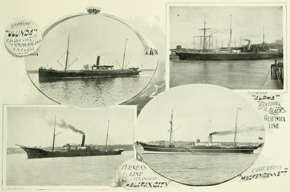
 |
| from: Glimpses In and About Halifax Nova Scotia; 1900; WH Howard on archive.org |
Above, Halifax as seen from George's Island c1900. Citadel Hill is the highest feature. The area of the Explosion, the Intercolonial North Street Station, and the ICR railway yards are up the harbour to the right. Notice the small-scale, ad hoc development of the waterfront and its piers.
 |
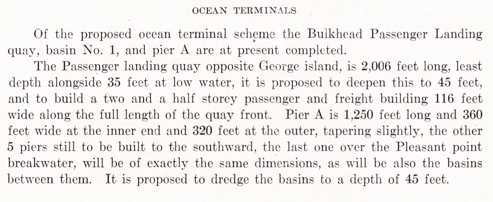
| from: Glimpses In and About Halifax Nova Scotia; 1900; WH Howard on archive.org |
Some typical ships in Halifax harbour c1900.
Masts on which to hoist sails are still present to supplement coal-fired steam engines.
 |
| from: Nova Scotia Illustrated, November 1895; GH Bradford. on archive.org |
This interesting map identifies the smaller piers
The concentric circles show the distance from the Post Office.
 |
| from: Nova Scotia Illustrated, November 1895; GH Bradford. on archive.org |
An enlargement of the map above shows the ICR facilities.
 |
| detail from: The Railways and Canada's Greatest Disaster; Douglas NW Smith; Canadian Rail No 431, Nov/Dec 1992; CRHA |
The 'corrected to 1917' map from the Douglas NW Smith's article in Canadian Rail is shown above
... and, below, rotated 180 degrees for legibility.
'X' marks the location of the Halifax Explosion.
| detail from: The Railways and Canada's Greatest Disaster; Douglas NW Smith; Canadian Rail No 431, Nov/Dec 1992; CRHA |
The ICR/CGR features are enlarged below.
 |
| detail from: The Railways and Canada's Greatest Disaster; Douglas NW Smith; Canadian Rail No 431, Nov/Dec 1992; CRHA |
* * *
 |
| from: Cinders & Saltwater - The Story of Atlantic Canada's Railways; Shirley E Woods; 1992; Nimbus. |
The photo above jumps ahead in history for just a minute.
Circa 1928, this photo shows the general arrangement at Pier 2 ... located within the 'ICR Piers' area in the map above. Canada's famous immigration location 'Pier 21' is located at the Ocean Terminals area ... out at the mouth of the harbour. Before Pier 21, this Pier 2 was the immigration pier. It was also used for departing and returning soldiers during the Great War. As Pier 2 was extensively damaged during the Explosion, this photo represents it after rebuilding.
* * *
During the Great War ... after the Halifax Explosion ...
After the Halifax Explosion, everyone got such a Royal Pranging - particularly the pilotage service at Halifax Harbour.
.. As if the Great War was otherwise so perfectly conceived and efficiently organized by the Generals and Admirals!
Then there were the lawsuits back and forth between the owners of the Imo and Mont Blanc - each claiming the other was at fault.
... One fine morning, someone tries to do things in a hurry and it makes all kinds of paperwork for everybody - not even considering the needless loss of life at Halifax. But the whole theme and lesson of the Great War is the needless loss of life.
* * *
Modifications to the Halifax Ocean Terminals Plan


I have reposted the images above (projected plan) and below (postcard view, circa 1960) so you can see how the elaborate architecture was modified due to the realities of Canada immediately after the Great War.
The images view the area from roughly the opposite directions. The drawing above is viewed from the north. The photo below was taken from the south.

* * *
Meanwhile ... back in the 1920s ...
Modifications to the Halifax Ocean Terminals Plan
Jim Christie found and forwarded this article describing the post-war adaptation of the more elaborate plans made for the Halifax Ocean Terminals before the Great War. I had wondered aloud to him about the process which caused the final design to be so different and he answered my question with this article!
... With the damage to the old Halifax harbour made by the Halifax Explosion of 1917, it made sense to accelerate the development of the more spacious Halifax Ocean Terminals. The article explains the changes made to the original plans and it documents the construction completed by 1920. This was the genesis of Canada's storied Pier 21.
Two images follow the article so you see the practical compromises made to the more elaborate pre-war design.
 | |
|
I have reposted the images above (projected plan) and below (postcard view, circa 1960) so you can see how the elaborate architecture was modified due to the realities of Canada immediately after the Great War.
The images view the area from roughly the opposite directions. The drawing above is viewed from the north. The photo below was taken from the south.
* * *
Meanwhile ... back in the 1920s ...
Unless noted otherwise, all of the following images come from Canadian Port and Harbour Directory; 1923; Government of Canada.

Above, at the top of the map, you can see the original Intercolonial Railway tracks terminating in the Pier 2 area.
The new Ocean Terminals (dotted outlines) and the Pier 21 area appear near tiny George's Island.

Above, the camera takes in little George's Island and looks toward the ocean.

This is probably the most interesting of these images. Across the Narrows is Halifax. The open ocean will be to the left.
If you look closely at the far shore, you'll notice that the individual buildings stand out as the land rises from the harbour. Between December 1917 and when the photo was taken in 1922 or so ... the blasted remains of destroyed buildings have been removed. However, except for buildings which survived and were repaired, and new construction, great expanses of urban land persist as vacant lots.


CGMM = Canadian Government Merchant Marine


The map below shows the old Intercolonial area near the end of World War 2.
 |
| from: The Naval Service of Canada, Vol II; Gilbert Norman Tucker; 1952; Minister of National Defence. |
 |
| from: The Naval Service of Canada, Vol II; Gilbert Norman Tucker; 1952; Minister of National Defence. |