As we travel southbound, you can contemplate some evidence from the 1969 Royal Commission.
We slept through Gillam and the crossing of the Kettle Rapids bridge on the Nelson River.
Above, is probably another crossing of the Nelson as we approached Thompson, Manitoba.
The unique headend traffic is still with us.
* * *
Unless otherwise noted, black and white images and diagrams are from:
Province of Manitoba Royal Commission Inquiry into Northern Transportation; Arthur V Mauro; 1969; Government of Manitoba.
Here is the former Hudson's Bay Company post at York Factory - at the mouth of the Hayes River.
Port Nelson, the original terminal planned for the Hudson Bay Railway, is on the nearby Nelson River.
The Canadian Government is getting the railway finished.
At Thompson, our train has turned on the wye and backed into the station.
Thompson was at the northern end of the provincial highway system.
A large item is being transferred to the brown van from the baggage car.
Our power sets off the trailers near the station.
The Royal Commission looked at some of the intermodal equipment the CNR had experimented with on the line.
From our trip log:
At Thompson, my spouse was talking to some men who had a canoe transported north in the baggage car for some fishing. It cost $3 to take the canoe one hour north. There had been a fire on the lake where they were fishing and water bombers had been working to extinguish it.
Above, Susan converses with a woman from Sydney, Australia. She had been travelling in Canada for about two months. Next, she was heading west. On the west coast she expected to take the CPR 2860 excursion on the BCR up to Squamish and to travel up to Alaska. She remarked on some of the strange questions asked on the Churchill bus tour by some of the visitors from the south.
... Like Canada, Australia has an interesting railway history and tradition - which included junctions of different gauges where all passengers were forced to transfer. If you listen to Australian podcasts about science or general news, you will frequently hear the expression 'down the track' - often used to indicate some time in the future.
Susan also recorded that our dining car waiter (Karen) asked where we were from and said it was nice to have some Canadians on the trip. Most passengers on this train were usually from the US or Europe.
A definite 'us and them' perspective had developed after our experiences at Churchill. As an example of our contrasting approaches ... Susan recorded that a birder from The Pas, as he got on the bus at Churchill, was told how much he looked like Spock from Star Trek.
"The brother of my uncle from Portage" worked here as a park ranger for a number of years.
* * *
Below, is some evidence submitted by the CNR to the Royal Commission.
Where roads do not exist, the alternative to rail passenger transportation up here is flying.
You can imagine some of the medical flights which take place in rough weather.
This is beginning to look like every vacation we ever took to the west through northern Ontario. There's some nice fresh ballast. Pierre Berton would note that the Canadian Shield landscape is a unifying, common experience for most Canadians.
At Thicket Portage, I recorded that we took the siding for the Way Freight - '295'. We were in MBS territory, I think, and train numbers did not appear in the employee timetable. Their train was led by four GP9s (probably a couple were deadhead), and included two auto carrier box cars, Branchline Rehabilitation Program hopper cars (for track ballast) and some autos on a flat car.
Steam or water is being discharged from the dining car.
* * *
Never to Sleep
Since the invention of the battery-powered radio scanner, my poor sleep overnight on trains has been guaranteed.
This failure to sleep had begun a couple of decades earlier when, as an eleven year old, I had been sent on a solo trip 'for fun' by roomette from Montreal West to Fredericton Jct via the CPR short line through Maine. My expectations had been far too high for the whole affair because of the prospect of a train trip. Most of my railway experience had been with daytime steam excursions using heavyweight equipment with opening windows.
... In reality, night fell shortly after the train left Montreal - the dimly-lit, brown roomette interior jolted erratically back and forth during that long, long night. One available diversion was switching on the noisy, vibrating rubber-bladed fan - Thomas Edison himself had probably clipped a blade on the DC thing, to ensure it ran unbalanced. You have already guessed the other pastime in a roomette: propping up the bed while trying to use the toilet. Outside was blackness.
... In more modern times, the spooky synthesized 'Mr Rogers' voice of a CP trackside detector in my earplug was an effective way to be jarred awake at regular intervals in a roomette or half bedroom. But, as working adults ... so little of our lives was vacation and spent on trains that I just didn't want to miss anything.
When the photo, above, was taken we had spent three consecutive nights on the trains to and from Churchill. Staying awake to experience the 'midnight sun' of June (actually twilight at this latitude) added to my sleep deficit. With 'Cornelius' (of the previous post) off the train, I was finally getting my fill of rear vestibule riding. The noise, wind, and fatigue from holding on and maintaining my balance eventually made me realize that it was time to return to the muffled peace of the sleeping car interior.
I made a point of staying a little longer. This era was coming to an end.
Indeed, this was my last view of the CNR ('Serves All Canada') from the rear vestibule of a passenger train. It was a warm, hazy summer day. The Canadian National Railways, as Canada's 'railroader of last resort', had maintained this bolted rail north of The Pas as if it was a main line railway. Just look at it. The steel wheels were clicking over the rail joints as we sped through the Canadian wilderness at 50 or 60 mph for hour after hour.
This photo goes with my carefully-preserved memory of those last minutes riding 'outside' on a quintessential Canadian railway through the bush of the Canadian Shield; the old, 'obsolete' government-owned railway line, its cast-off steam-heated cars, communication wire lines, well-maintained right of way and bolted rail.
To borrow Rolly's phrase: The Pride of the Past.
* * *
Duff, the VIA 1 Food Tasting Attendant, based at Wabowden,
comes to meet the train.
* * *
The Pas
Our notes indicate that Barry (our sleeping car attendant) and Karen (our dining car waiter) told us where we could find ice cream at The Pas and the four of us headed off to get some. The record shows that we discussed world politics and 'some Americans' on vacation.
Later, as you see, Susan resumed her conversation with Margaret Tate of Bexley, New South Wales, Australia.
The next morning, the sun was up early and so were we - for our early morning arrival at Portage. The train was running late, so Barry slipped a note under our door, giving us an estimate of our revised arrival time at Portage.
Looking back, travelling to Churchill turned out to be our best VIA experience of all the long distance trips we took. VIA Montreal replied to the letter we sent expressing our appreciation for Barry's efforts to make our trip so enjoyable.
Train 93, the Hudson Bay, departed Winnipeg on Thursday, June 18, 1987
and we boarded at Portage la Prairie at around 2310hr.
We would travel almost 1100 miles in the next 33 hours or so. After about 12 hours in Churchill, we'd return - another 1100 miles over 33 hours.
We were seen off by my aunt and uncle who had previously made the trip and who had encouraged us to see this part of the Canadian north. With interest, we had read the history books and articles which they had mailed to us to help us prepare and appreciate our journey ... in the days before the internet. Canada Post had struggled under the weight of tomes by Pierre Berton and Farley Mowat, and newspaper articles on the Canadian Wheat Board, Transport Canada and the future of Churchill.
To oversimplify the many accounts of arctic exploration: Generally, early European explorers of the Arctic saw themselves as superior to, and they were standoffish toward ... the local animal-hide-wearing 'savages' (hello, Royal Navy!). Generally, these superior beings were found frozen to death, emaciated, with no teeth, in their tents ... if they were ever found at all. Those who embraced indigenous ways did quite well and even made new friends along the way!
As the result of packages dispatched from Portage, our northern knowledge spanned everything from Henry Hudson and Jens Munk and their 'high-mortality tours' ... to the Hudson's Bay Company.
We knew that the Franklin Expedition's Ultimate Mortality Tour led to a less hubristic and more systematic exploration of the Arctic - by diverse expeditions - to solve the Franklin mystery. Apparently, without a trace, the Franklin Expedition had vanished from the face of the otherwise-perfectly-ordered Victorian earth.
The era was capped by the indisputable bi-polar firsts of Norwegian Roald Amundsen and his added achievement of being the first to complete the Northwest Passage: 1903-1906.
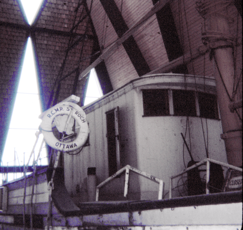
Previously, I had picked up my own knowledge of Pierre Le Moyne d'Iberville by lounging in front of CBC TV ... and Henry Larsen from a library book I found when I was still in my single digit phase. Having read the book at an impressionable age, actually seeing Larsen's little St. Roch at Vancouver in 1968, and restored in 1982, were particularly memorable experiences.
* * *
Train 93 in 1987
On the schematic 1958 Official Guide map below, you will conclude that our trip began on some old Canadian Northern Railway routes. From Portage, we proceeded via Gladstone and Dauphin, Manitoba and CaNoRa (not a 'misspelling' of Kenora) and Hudson Bay (Junction), Saskatchewan. After the station stop at Hudson Bay, Saskatchewan, the train reversed, a switch was thrown and we then advanced north at a right angle to the station lead.
Official Guide, 1958. Collection of LC Gagnon
* * * Friday, June 19 Late in the morning, we found ourselves at The Pas.
At The Pas, Manitoba. Our power 6301/6302 had been rebuilt at the CNR Pointe St Charles shops in 1983. This included 'light-weighting' the units by removing their steam generators.
(Our passenger train, heated by steam from the locomotive, demonstrates the persistence of steam engine technology from circa 1880 ... Cars each had their own steamlines - which were coupled along the length of the train by a carman with a hammer when the train was made up)
Thus lightened, our locomotives were better suited to the unstable 'floating' roadbed built on the deep muskeg near Hudson Bay. However, our train now required a steam generator car - which is seen behind the power. Making steam was still the responsibility of the engine crew in the 1980s.
Believe it or not, VIA functioned with 1950s equipment for much of its early life. Historically, our 6300s were sort of analogous to the immortal B-52 bomber airframe of the US Air Force.
In the words of a VIA employee of the era, the refurbished 6300s were 'brand-new 30 year old locomotives'.
We were in the former CNR sleeping car Edwardsville - built in 1954. It was customary for VIA's predecessor railways' wool sleeping car blankets to still be in use well into the 1980s. Dyed in the wool railway crests made the blankets theft-resistant and fixed the age of the blanket within Canada's glorious railway history - Beaver Crest! .. Maple Leaf Herald! .. Lachine Remount Depot!
... Aside from railway enthusiasts, who else would have stolen these blankets? ... maybe collectors of hospital patient gowns and other textile fabrications for Lilliputians.
With a recent rare infusion of new money, VIA had just issued new uniforms to its onboard staff. Our VIA crew was young and their morale was very good - perhaps being away from VIA mainline supervision accounted for this.
Our car attendant provided the best service we ever had on our travels over the years.
In history, The Pas generally marked the political, construction and operational beginning of the Hudson Bay line.
A little to the north of The Pas, another line branches off with routes to Flin Flon and Lynn Lake.
In the early 1980s, we had watched cargoes like those above loaded onto VIA's premier train - The Canadian.
VIA was the underfunded steam-heated pickup truck running through Canada's roadless wilderness.
Some yard facilities can be seen as we look south from the station.
Spot the locomotive engineer waiting for his iron horse.
Ten minutes after our scheduled departure, the Lynn Lake train was scheduled to leave on its 240 mile, 10 hour journey. On this train, in-car space heaters harken back to the days before 'modern' trainlined steam heat technology. However, my notes record that a steam generator was added.
In the afternoon ...
Later in the afternoon ...
We were in the rear vestibule from Wabowden to Thompson.
It was hot and sunny.
This shows the 'tail' of the Thompson Sub wye.
Down the wye to the right is The Pas, to the left is Churchill.
The train ran with the power leading to Thompson.
The train turned on the wye at Thompson and backed into the station.
Atlas of Canada; 1981; Reader's Digest Association.
The map above shows the railway (grey) from The Pas to Thompson.
The highway system is shown in red.
The VIA timetable states it is 714 miles from The Pas to Thompson.
First Nations Reserves are named, numbered and the reserve area is shaded in red.
With the Thompson passenger station at that right, and the afternoon sun behind us, you can see that the people travelling in the coaches are boarding the first of three coaches. Closest to the camera (with the little door hatch) is the dining car. The sleeping cars follow the dining car.
At the end of the Manitoba highway system, Thompson saw us transformed into a sort of mixed train with highway trailers bound for Churchill added to our train.
Another aspect of the train's duties (found in our notes of the trip) was to drop off supplies for railway maintenance of way crews.
These unique steam trainlined piggyback (TOFC) flat cars were cut in before the passenger consist. The steam is not used by these freight cars, but it must be passed through to the passenger cars for heating. Having freight on the tailend of the consist would subject the occupied passenger cars to dangerous buff forces in the event of a derailment or collision.
Another view of our train at the Thompson station.
We left Thompson about 30 minutes late, so around 20hr.
A railway roadbed without adequate culverts to relieve water pressure building up on one side is a 'dam'.
Freshets from thaws, torrential rain and burst beaver dams are not always predictable.
I don't know what happened here, but fun and surprises often attend a wilderness railway such as this.
We were in the vestibule from Thompson until Pikwitonei (shown above).
You can see that the train's arrival is still a significant event.
Again, the first coach is handling the passengers.
* * *
Saturday, June 20
The early hours of June 20 were eagerly anticipated as the longest period of daylight we would see. There were strong thunderstorms with very bright lightning around midnight. Probably without a clear sky above: at 01hr, I could still read the large print of a newspaper without using artificial light.
At 0420hr, we were at Weir River and about 90 minutes late. Pre-dawn light on the horizon had started around 03hr. There were no trees over 20 feet in height.
The early morning gave us a good view of the scenery closer to Hudson Bay.
As the timetable below shows, we were travelling about 175 miles with speed limited to 30 mph.
CNR Prairie Region Timetable 27, October 27, 1985.
CNR Prairie Region Timetable 27, October 27, 1985.
Outside, it had become overcast and cold.
Hudson Bay typically bends the average isotherm lines south around itself in summer.
A cooler air mass had probably moved over us during the night as well.
The overnight difference in external coach temperature was at least 25 degrees Celsius.
I think you can see someone's distant smudge to the right of the tracks.
Notice the electricity pylons - freeing Churchill from dependence on local coal, then diesel-powered generators.
Demographically, as Canadian tourists, we seemed to be 'rare birds'.
'Older' American polar bear tourists and birders seemed to be the most prominent group riding south of the dining car kitchen.
(The dining car usually separates the coach passengers from the extra fare sleeping car passengers)
In size, after the large American group, there were a few Canadian residents returning to Churchill.
In hindsight, we can assume that we never met the most typical users of the train - northern residents living along the line itself.
Over breakfast, I asked a returning Churchill resident in the tourist trade about the future of Churchill. Susan later recorded our conversation in our trip account ...
He thought it was encouraging that the CNR [still a Crown Corporation then] had agreed to invest $1.5 in new development at Churchill. He said there was much talk about possible development but no new ideas ... possibly a supertanker port linked to a trans-western oil pipeline; or a nuclear submarine supply depot; or a wildlife reserve. We learned that if you fish in tidewater at Churchill you require a Manitoba fishing licence as well as one from the Northwest Territories [Nunavut was not separated from the NT until 1999].
He thought that Canada taking on the job of keeping the Northwest Passage open to demonstrate a claim on the waters was stupid - the passage being as much international waters (he thought) as the Persian Gulf. The Americans would be there regardless. He predicted economic development would be delayed by unsettled land claims and this included the current Inuit and Dene claims - which overlapped each other. He thought that the decisions made would be 'political' and would have little to do with the wishes of the northern people.
... Over the years, our vacations were perhaps more pleasant because we seldom talked to the real people who lived in the areas of Canada we visited. Our trips were getaways by car or by railway sleeping car ... to escape the internecine hospital politics of our workplace. We surveyed the land and its features - often tracing the convenient guiding framework of railways. We studied the museum-based histories of the land's geology and natural life ... and the efforts and achievements of humans to find a way to survive on the land - and with each other.
Almost at Churchill.
Imagery date June 15, 2014 - from: GoogleEarth
On this GoogleEarth view of the Churchill area, you can see the Churchill River to the west, and the Googletized salt water of Hudson Bay to the north. In the north-west, the tracks reach the townsite and the station, and beyond that: the elevator and its rail yard, oil storage tanks, etc.
Our passenger train was wyed and then reversed into the station.
To the north-east are military lands (e.g. the former US Army Air Corps/Force Fort Churchill, 1942) and the airport. During the excellent bus tour - which was enjoyed by many of our train's passengers - we were told that the runway is two miles long and that it can accommodate B-52 bombers. In addition to receiving NORAD planes or commercial aircraft in distress, I assumed there was another possible reason for the investment in this installation. Our visit took place just before the miraculous end of the Cold War. (Without much justification, we seem to worry less about the same risk of nuclear annihilation today) During that era, some of us educated ourselves on the false metaphysical theories underlying 'limited nuclear war' ...
During a superpower confrontation, strategic bombers (i.e. city bombers like the B-52s) would be advanced from US 'homeland' bases which were certain to be targeted ... and these aircraft would be dispersed farther 'forward' to hopefully preserve them for later potential use as the war progressed. Upon being told that B-52s could land here by the tour host, in a low voice I insensitively said to my spouse - with the hope that I would be overheard by a few of our American co-tourists - "If there's a war, Churchill gets it!"
* * *
Arrival at Churchill, Manitoba after wyeing the train at 0845hr.
The camera is facing south at the Churchill station, with yard limits and the sea behind us and Manual Block System traffic control beginning at the sign. Our train has backed into the station and the first order of business will be setting off the TOFC flats for unloading during the day.
As we would be leaving with the same equipment that evening, we checked our suitcase at the station so we could enjoy our Saturday at Churchill.
Our tour bus was a brand new yellow school bus with a good HEATER.
The tour was conducted by a member of one of Churchill's original families - about which we had read in Churchill history books.
His family immigrated to Canada from Norway in 1925.
Vacation fun fact: Around the first day of summer, we found that Hudson Bay had some open water ... but Lake Louise, Alberta had none.
The next post will show some of the sights of Churchill - many were railway related. While we would have been pleased to see polar bears, most of them had headed inland for the denning season. With no seals to eat on land, they would return - hungry - in the fall, waiting for the ice to form so they could get out on the bay and resume hunting. Churchill stands on the bears' traditional route back to the sea.
As another preview of our tour, here are some of my spouse's notes ...
'As soon as we got on the bus, some people, who chose not to eat on the train, chose to take up our bus tour time [$20 a head .. $37 in 2015 + the lost opportunity to see Churchill] and whine about needing breakfast. So our very pleasant tour conductor (with the patience of a saint) agreed to take everyone to the Community Centre where there was a cafeteria so that these ones could eat.
...
'At one point, a member of the Bus Group attempted to speak with the Bird Group and the Bird Lady said - 'Many Canadians like to come to our climate in the winter because our winter is lack their summer' and the Bus Lady said 'Well we're not Canadians we're American' like she had just been insulted and the Bird Lady said in a very cold tone ...
"I know that, I am telling you how it is!"
'I've heard that used a couple of times this trip. It is to inform the other party that it is not up for discussion - it is a fact.'
The next posting will look at some of the railway features of Churchill.
First, to answer this on a personal level, my aunt and uncle had already made this trip and they had found it worthwhile and interesting. They always encouraged us when it came to our exploration of Manitoba and its history. In fact, their influence went well beyond Manitoba, but it is fair to say that their positive experience was very helpful in our decision to take this trip. Starting off from our 'vacation base' at their home, they put us on the train late at night at the Portage station and picked us up when we returned early in the morning.
We went because it was an easy and interesting train trip into Canadian history.
The historical question regarding why a railway was built to Hudson Bay is harder to answer ...
* * *
from: Historical Atlas of Manitoba; 1970; Warkentin and Ruggles; Manitoba Historical Society
As this 1762 map by Thomas Jefferys shows, the features of the western shore of Hudson Bay
were known and named for over 120 years before anyone considered building a railway there.
The Hudson Bay Railway was quite unlike the Canadian Pacific Railway or the Intercolonial Railway. Both of those were built - ostensibly - because the smaller British colonies on the 'other end' demanded 'their own' railways for commerce and for military protection. The people 'out there' made a political demand as part of their price for joining Confederation.
In the northern case under investigation, there was no distant colony to speak of on Hudson Bay ...
With all due respect to the indigenous people and to the Hudson's Bay Company personnel ... nobody lived up there!
Who wanted this railway?
Why was anyone willing to pay for it?
An early map of a Hudson Bay Railway ...
from: Historical Atlas of Manitoba; 1970; Warkentin and Ruggles; Manitoba Historical Society
A couple of efforts were made to investigate or to survey a line to Hudson Bay in the 1880s. In 1886, 40 miles of track were built north from Winnipeg to Shoal Lake - above, that very first lake north of Winnipeg. The print on this map is particularly tiny - but it is a big land!
Unlike the route which was finally built, this line would have run directly to the Bay from Winnipeg ... between Lakes Winnipegosis/Manitoba and Lake Winnipeg - so through the 'Interlake Region'. But like the final route, this one ends at Churchill.
As you recall, the Canadian Pacific Railway was built to bring tiny, distant British Columbia into Canadian confederation, and to occupy and legitimately claim the former Hudson's Bay Company lands ('Rupert's Land') for the British Empire, rather than see them fall into American hands.
T.D. Regehr in his 'The Canadian Northern Railway - Pioneer Road of the Northern Prairies, 1895-1918' (1976, Macmillan) wrote ... 'a clause was inserted in the [CPR] contract which forbade the construction, for twenty years, of any railway lines within fifteen miles of Latitude 49'. This was to protect the CPR from connections to the US railroad network and the siphoning off of traffic needed to earn the private CPR a profit. As a safeguard for shippers, the Canadian government could intervene if the CPR profits through this sparsely settled wilderness exceeded 10%.
The small scale of the rickety railway line, and the small-capacity railway equipment of the CPR ... and the labour-intensive, horse-powered farming and road transportation of the first prairie farmers ... can be difficult for us to imagine today.
The lack of experience with prairie farming conditions in Canada, and the weaknesses of the first cultivars planted ... were also challenges which were difficult to overcome at first. Before the wheat pools were formed, Ogilvie Milling Company grain-buying and flour-milling business practices also caused discontent among farmers.
So ... the farmers got mad. And they blamed the CPR for charging too much ... it had a monopoly. They simply couldn't survive with the prices they were getting for frost-damaged wheat - after the CPR transportation costs were charged.
An article in the Montreal Gazette in December 1885 suggested that members of the Farmers' Union of Manitoba were being whipped up ... 'as in the republic to the south' ... 'by ambitious and self-seeking adventurers, the ignorance, the credulity, the selfishness, the good nature of those who compose the gatherings are similarly worked upon and made subservient by the demagogues whose breath of political life is agitation, and the price of whose burning patriotism is a salaried office'. The article continues ...
from: Montreal Gazette; Dec 22, 1885.
... so said an article written in the city which housed the head offices of both the CPR and the Ogilvie Milling Company.
from: The Winnipeg and Hudson Bay Railway; Hugh Sutherland, President; 1887; Winnipeg. archive.org
But again ... If western farmers could 'disintermediate' the CPR and eastern grain interests, the grain could be shipped more directly to Britain ... with more money left in the farmers' pockets.
If only someone would pay for the railway ...
To spoil the story's ending ...
Official Guide, 1958. Collection of LC Gagnon
During our 1987 trip, the route we followed went from Winnipeg/Portage, to Hudson Bay (Junction) Saskatchewan -
then north to Churchill.
This standard rail map format takes certain cartographic latitudinal liberties.
The route north is 'steeper' and longer than illustrated.
* * * Historical Interlude Picturing Canada Back Then
Canada Handbook 1935; Dominion Bureau of Statistics.
The dates on the map above represent the creation of areas as integral parts of Canada,
the date of joining Confederation, or the date of boundary revision after joining.
Canada Handbook 1935; Dominion Bureau of Statistics.
The sharp decrease in the population of the Northwest Territories reflects the 'Northwest' being reallocated to the prairie provinces,
and also extending the boundaries of Quebec, Ontario and Manitoba farther north.
Fun fact, 1921: Includes 485 members of the Royal Canadian Navy.
* * *
The Canadian Northern Railway began its life in north-west Manitoba (Manitoba, as it is pictured above) and the CNoR went on to become the railway of the northern Prairies - particularly in contrast to the CPR's southern route. With its rich branch line network, the CNoR might have done well for a while if it had simply continued to use the CPR as its bridge railway to get its grain to eastern ports.
All this changed when the comparatively ancient Grand Trunk Railway (by then over half a century old) announced in 1902 that it was going to become a transcontinental railway - building the Grand Trunk Pacific west from Winnipeg to Prince Rupert on the Pacific coast. (The National Transcontinental arrangement with the GTP east of Winnipeg didn't work out ... but that's another long story)
This new competitive escalation of the Grand Trunk in the west ensured that the CNoR (heretofore happy at home on the Prairies) would now have to expand into eastern Canada and become a transcontinental itself.
In the midst of this competitive turmoil, many people were optimistically hoping that the 'railway of the northern prairies' would build the Prairies a line to Hudson Bay ...
from: Boston Evening Transcript, Dec 15, 1905.
The Canadian Northern system ended at the bridge across the Saskatchewan River at The Pas (pronounced 'paw'). William Mackenzie (of the Canadian Northern) offered Prime Minister Laurier three options which could interest the CNoR in building the Hudson Bay Railway. They were all too rich for Laurier. The potential returns of the Hudson Bay Railway were too poor for Mackenzie and Mann of the Canadian Northern - or any other railway, like the Grand Trunk Pacific.
But 'The Prairies' were still clamouring for their own deep-water port.
Clifford Sifton, Laurier's Minister of the Interior until his resignation in 1905, was the mastermind behind much of that regime's very successful efforts to populate the Prairies with immigrants. He came up with a suggestion.
In the past, railways across the west had been financed and supported by federal government cashgrants, subsidies and service contracts; or land grants to the railways along their planned lines which the railways could re-sell to settlers, or mortgage as security behind their own debt securities; or government guarantees of railway debt securities.
Sifton suggested that the land grant system be wound up and that unearned railway land grants should be sold off to the benefit of the government. Three million acres of these lands would be chosen, segregated and sold (eventually) to fund the Hudson Bay Railway. So if you trace this land asset back to its origins, it was the indigenous people of Canada who financed the Hudson Bay Railway.
* * *
Later ... in 1913 ...
The following 11 images come from the annual report to Parliament
of the Department of Railways and Canals for the fiscal year ending March 31, 1913.
The following map is presented in two parts because the blogging software could not reproduce it properly as a single image. North is roughly to the right. This map, printed on thin paper and bound into the book, was refolded in the wrong way for perhaps 20 to 100 years. The thin paper was extraordinarily resistant to flattening for scanning.
The inclusion of the Hudson Bay Railway in this report to Parliament evidences the fact that the Hudson Bay Railway had been taken on as a government project.
from: Railways and Canals Report, 1913; F Cochrane, Minister of Railways and Canals; Government of Canada.
from: Railways and Canals Report, 1913; F Cochrane, Minister of Railways and Canals; Government of Canada.
The bridge was completed in 1912, and the locomotive is (symbolically) facing north.
from: Railways and Canals Report, 1913; F Cochrane, Minister of Railways and Canals; Government of Canada.
The map shows the route chosen to Port Nelson, but I was careful to scan in Churchill in case we need it later ...
from: Railways and Canals Report, 1913; F Cochrane, Minister of Railways and Canals; Government of Canada.
from: Railways and Canals Report, 1913; F Cochrane, Minister of Railways and Canals; Government of Canada.
from: Railways and Canals Report, 1913; F Cochrane, Minister of Railways and Canals; Government of Canada.
from: Railways and Canals Report, 1913; F Cochrane, Minister of Railways and Canals; Government of Canada.
from: Marine Engineering; June 1913; MacLean Publishing. (researched by Jim Chrsitie) archive.org
from: Marine Engineering; June 1913; MacLean Publishing. (researched by Jim Chrsitie) archive.org
The lives of the surveyors and workers - who toiled in the bush far away from towns - were particularly harsh and difficult. The cold and primitive winter working and living arrangements; the remoteness of the work; the insects which hatched out of this water-logged land in summer ... really took the fun out of building a railway.
Above, only a lighter could dock at the inadequate 'fisherman's landing' at Port Nelson as freighters from Halifax and Texas (seven in all during 1913's short navigation season) waited at anchor for unloading. One of them ran aground and was wrecked - another was seriously damaged. The seasonal freeze-up was quickly approaching, making the captains anxious to be off ... and the rising and falling tides, and hastily improvised aids to navigation probably made them even more antsy.
Speaking of ill-fated vessels, the dredge Port Nelson was built at Toronto, costing over $250,000 (about $5 million today). It was towed 3000 miles under the supervision of a captain for Lloyd's Underwriters to Port Nelson, and ended its days there.
The chaos at the landing and disorderly storage of construction materials (above) was matched by the chaos in the House of Commons for Frank Cochrane, Minister of Railways and Canals in the Borden government. The fiasco of Canadian railway overbuilding - particularly the National Transcontinental and Grand Trunk Pacific mess ... and the Port Nelson Clown Show gave the Opposition plenty of material for pointed questioning of the Minister. The Great War would change the picture for a while, but not the underlying problems.
from: Railways and Canals Report, 1913; F Cochrane, Minister of Railways and Canals; Government of Canada.
from: Toronto Sunday World; February 17, 1914.
So, if you insist (Frank Cochrane), the railway line construction can proceed to Port Nelson, with its poor natural harbour providing inadequate shelter for ships at anchor.
The Nelson River, running at 6-7 miles per hour, dumped so much silt at its mouth that even building an artificial island far from shore with its own railway bridge wouldn't solve the harbour depth problems for ocean-going grain carriers.
The Great Wall of China and the abandoned Port Nelson Bridge are both visible on GoogleEarth.
from: The Battle for the Bay; Grant MacEwan; 1975; Western Producer Books.
With the government eventually forsaking Port Nelson, it had to build its railway through the country illustrated below. Some sources suggest that Port Nelson was initially favoured because no one in Canada had yet built a railway over land like this ...
from: GoogleEarth
Shown above is about 20 miles of flat, undrained, unstable land which had been avoided by building the terminal at Port Nelson. The black line represents today's railway route.
With the rejection of silty, unsheltered Port Nelson as a terminal, the line had to be built over 70 miles of the type of terrain shown above. It reportedly had three to seven feet of muskeg as the only surface on which the railway could be built.
from: Railways and Canals Report, 1913; F Cochrane, Minister of Railways and Canals; Government of Canada.
Above: Building track on ground which was more solid.
from: Altitudes of Canada, 1915; James White: Commission of Conservation; Government of Canada.
In 1915, the Canadian Northern still ended at The Pas.
The Great War was on and the Canadian Northern was months from bankruptcy and nationalization.
The Hudson Bay Railway was eventually built as follows:
1914 to Sipiwesk
1915 to Manitou Rapids
1916 to Kettle Rapids
1927 to Amery
1929 to Churchill
* * *
Finally in 1931 ...
from: Canada Handbook 1932; Dominion Bureau of Statistics.
from: The Battle for the Bay; Grant MacEwan; 1975; Western Producer Books.
* * *
World War Two
from: Canadian National Railways; System Public Timetable; April 30, 1944.
In 1944 a public timetable shows that both passenger and mixed trains
(e.g. train M3 - made up of both passenger and freight cars)
were operated during World War Two.
The seemingly odd schedules for trains M3 and M4 reflect the need to perform switching and other local freight/baggage and express work by daylight if possible. With bad weather, equipment problems, track problems and derailments, opposing train delays, and very unusual loads for the wilderness where everything arrives by rail (e.g. boats, ungulate carcasses, fuel) ... the crews would have been quite happy to see the beds inside the caboose, or their other boarding arrangements, by the end of their often extended workdays.
As the timetable shows, the Hudson Bay Railway was finding another use ...
as a supply route to enable the construction of northern military bases
and northern military operations during the war.
From a location five miles north of The Pas on the Hudson Bay Railway ...
in 1929, the 87 mile Flin Flon Sub had begun connecting the line to Flin Flon,
(for fictional Josiah Flintabbatey Flonatin)
the site of rich copper and zinc deposits.
These were strategic materials during wartime
which were made accessible by the Hudson Bay Railway.
In turn, a 13 mile branch off the Flin Flon Sub reached Sherridon (nickel mines) in 1930.
Detail from: Official Guide, 1958. Collection of LC Gagnon
The map above is schematic and distances are not to scale.
* * * In the 1960s
from: Canadian National Railways; System Public Timetable; April 27, 1969.
Compared with 'essential travel only' during wartime, the line seemed busier in 1969 (above). The public was offered a greater variety of passenger-carrying trains and travel days. Trains 91 and 90 seem to represent an 'express' which ran to Thompson - where the equipment was turned for the return journey to The Pas.
In 1953, the 40 mile Sherridon Sub (mentioned above) was extended to 185 miles to reach Lynn Lake (nickel and gold deposits).
In 1957, the 30 mile Thompson Sub was put into operation to serve a major Inco nickel mining and production centre. During our visit in 1987, the passenger train left the main line and ran the full length of this subdivision, lifting intermodal highway trailers (piggyback) for furtherance to Churchill ... photos in the next posting. Thompson marked the northern end of the Manitoba highway system at that point.
Hudson Bay: Why?
The Hudson Bay Railway never did fulfil the economical grain-exporting dreams of its late 19th Century Prairie promoters ... nor did it win much popularity for the successive federal governments which studied, re-studied, built, re-built and paid for it - over almost half a century of Canadian history.
Once established, the railway met other important needs in the Canadian north for all-weather transportation ...
Providing local transportation for people living along its line, including transportation to cities for health care and education.
Assisting in the development of mineral resources.
Supporting military operations and training in the arctic, and scientific research of the north.
Serving as a heavy freight hauler for the re-supply of other northern settlements through Churchill's port.
* * *
For Further Study:
After posting, Jim Christie found this remarkable video on the Winnipeg Free Press YouTube site about a trip of boosters of the Hudson Bay Railway along the length of the Hudson Bay railway to Port Nelson.
I have provided partial Archives of Manitoba search results if you wish to formally refer to the original film, should the YouTube link break ...
Film entitled "The Seaport of the Prairies," 2 reels; Frank (Francis J. S.) Holmes for J.L. Thomas, North Country Tourist Association, Winnipeg; Date 1925
Starting from Winnipeg in August or September, the group eventually reaches the end of 'steam' track at Pikwitonei, and continues on with flanged-wheel gasoline vehicles. At the end of track at the Kettle Rapids bridge, the group embarks in the canoes of skilled Cree paddlers and travels to the head of navigation on the Nelson, where they are met by government launches for the trip to Port Nelson.
At Port Nelson the construction tank engine takes them across the dual gauge track of the bridge to the 'artificial island'. The dredge Port Nelson is also filmed - balanced on a dock to protect it from the ravages of winter ice and storms.
The return trip is recorded, ending at Winnipeg Union Station.
Before the end of the film, each white participant is filmed, with a card describing his role/title and his activities on the trip.
The film depicts travel in the Canadian wilderness by canoes, including tracking upstream. Contemporary bridge technology is shown, including wooden trestles. After apparently seven years without any 'maintenance of way' the effects of weather and water on the roadbed and track can be seen. On the return trip, the gas motor cars traverse a washout bridged only by suspended rails and ties.
The most unusual sequences are taken from the locomotive pilot (it seems) heading northward between The Pas and Pikwitonei where the steam locomotive (CNR 420 2-6-0 CLC 1914, scrapped 1932, a former McArthur railway contracting engine used to build the railway) and a mixed train operate over some significant sags in the track. The film states that the service on this section of the railway is bi-monthly.
Note: There is a 2 minute lead before the film starts.
Seaport of the Prairies - MB Archives (1925)
from Winnipeg Free Press YouTube
Thanks again to Jim Christie for finding this remarkable film.