To see the photos and maps covering the line between Schreiber and Nipigon, just click on the link below:
CPR Nipigon Sub (Part 1), Schreiber to Nipigon, 21 May 1986, Photos by Eric D Gagnon
To see an employee timetable from this era, click on the link below and the timetable will open in a new tab.
Nipigon Subdivision, employee timetable, June 1 1985
About the topographical maps:
The maps reproduced here are Canadian government maps showing data from the late 1970s. While I looked at reproducing convenient maps from Google and checked the on-line Canadian Rail Atlas ... I chose to wrangle these 25 by 36-inch sheets onto the scanner and then roughly patch the resulting images back together (sometimes the line nips onto another whole sheet for just a few miles).
Historically, these maps are more interesting and they closely represent the features shown in the photographs. Some of the industrial facilities no longer exist today. As I went through the photos, it was obvious that having the CNR Kinghorn sub (part of the original Canadian Northern Railway main line) mapped was a key advantage of using these maps.
The maps were originally purchased to better understand the line along Lake Superior. However, the decision to calibrate them (very roughly, as you can see) by railway mileage was the result of purchasing the Simmons-Boardman Trainsim program to run on one of the first PCs available in the late 1980s.
I used the usual geography class tricks (e.g. a mile-calibrated paper edge to pivot around curves). Interpolation of mileages between sidings provided a check against a cumulative mileage error as I headed west. The next step was to record the estimated mileages where the contour lines (elevation) crossed. It was also necessary to learn about railway curvature because the program was designed to factor this variable into its train dynamics as well.
A hand-written table of mileages, altitudes and curvature was then manually entered into the program - the first configuration of this PC had neither a mouse, nor a hard drive. Running a train was done through command prompts and keystrokes.
After having some experience with operating 'trains' of various chosen characteristics (one could only 'cheat' to a limited extent on coupler knuckle strength) over the Heron Bay and Nipigon subdivisions in the computer, I spoke to Rolly about some of my experiences. He seemed generally impressed someone could gain those insights into the line from using just maps and a computer.
Railways have long since seen the wisdom in producing accurate visualizations of their lines' physical characteristics (i.e. profiles) for running trades crews. With these visualizations also came prescriptions for throttle and dynamic brake settings all the way along the line.
Oh, and I found an interesting railway history 'artifact' on the last map. You'll see my notes about it when you reach the end of this post.
 |
Nipigon mile 63.3
Site of former station at the right. |
 |
| West switch Nipigon mile 63.3 |
 |
| West of Nipigon, CN Kinghorn subdivision (notice the bolted rail) at right. |
 |
| Switch to interlocking with CN at Red Rock, approximately mile 67.5 |
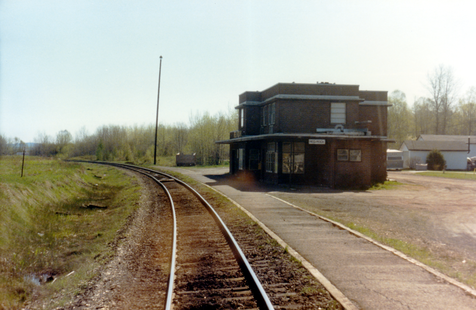 |
| Red Rock mile 68.3 |
 |
| East switch Sprucewood mile 72.4 |
 |
| West switch Sprucewood mile 72.4 |
 |
| Eastbound at 1040hr on CNR Kinghorn subdivision, Eng 5148 5057 50 cars |
 |
| East switch Hurkett mile 81.0 |
 |
| West switch Hurkett mile 81.0 |
 |
| Slow order 30 mph, bridge, mile 83 |
 |
| Bridge mile 84 |
 |
| East switch Bowker mile 92.9 |
 |
| Bowker mile 92.9 |
 |
| West switch Bowker mile 92.9 |
 |
| East switch Loon, mile 102.4 |
 |
| Loon, mile 102.4 |
 |
| West switch Loon, mile 102.4 |
 |
| Bridge, mile 106 |
 |
| Near mile 120 |
 |
| Cars on CNR near Thunder Bay |
 |
Thunder Bay North, mile 128.5
Left to right: former Canadian Northern Railway, Port Arthur station (black hip roof); Pagoda (tourist information); Prince Arthur Hotel (seen over baggage car). |
Notice Baird in the top left corner of the map below.
Baird was on the Lake Superior Branch of the Grand Trunk Pacific Railway. This line left the National Transcontinental at Superior Junction.
Altitudes of Canada (James White; 1915; Government of Canada) lists the stations as:
mi 181.8 Baird 920 feet above sea level
mi 188.8 Alba 750 feet
mi 194.4 Canadian Pacific Ry main line crossing 636 feet
mi 195.0 Fort William station 613 feet
 |
| CNR Superior Junction looking timetable east 2012. |