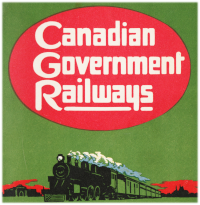
The Grand Trunk couldn't handle it. The Winnipeg to Quebec City section of their direct transcontinental railway was to stay in the hands of the Canadian government.
By the time this booklet came out, many had died ...
Charles Melville Hays, the Grand Trunk President ... died in 1912 ... at 41°43′32″N 49°56′49″W. His grand American vision to dominate the competition with his own transcontinental railway had certainly shaken up the fuddy duddies on the Grand Trunk's far-away British board of directors.
Prime Minister Sir Wilfrid Laurier ... died in 1919 ... after losing his last election in 1911 to Robert Borden (Borden was the last Canadian prime minister to be knighted: in 1915). Laurier had many reasons of his own for being the key proponent of the Quebec City [Cochrane] Winnipeg routing ... to join the Grand Trunk Pacific at Winnipeg for its well-built western projection through to the new port at Prince Rupert.
And between the time the Grand Trunk Pacific was completed in 1914 and this booklet was printed circa 1920 ... 115,000 Canadians had died ... 60,000 in World War 1, and 55,000 in the flu pandemic.
Canadians in 1920 were tired of death, they were tired of war, many were tired of the British Empire, and they were tired of ... railways.
Unfortunately, as lenders of last resort for these vast railway systems, Canadians ... and their progeny for generations to come ... were coming into a rather large portfolio of them. By 1920, the name for that portfolio - Canadian National Railways - had already been chosen.
As you can see, the GTP-forsaken National Transcontinental was already contained within the old government portfolio name (CGR) and bureaucrats were trying to promote it for what it was. The NTR was a new wilderness railway with sporting potential for tourists, and forest, mineral, and water power resources along its route. If you wanted to farm 'up there' you could make the arrangements.
* * *
Below, is a map of the segment of the NTR covered in this post.
Cochrane is in the top left corner, Quebec City is at the right.
It is the usual Poole Brothers (Chicago) map which turns every railway into a smoothed 'air line'.
 |
| from: Canada, Pacific to Atlantic, The National Way; 1921; Canadian National Railways - Grand Trunk. |
Below: My cousin is a farmer who has seen many old 'in the tall grain' photos ...
1) Get the shortest member of the party. 2) Have them kneel in the crop.
Unless you need a lot of straw, the size and condition of the seed head is what really counts.
Tall grain is more likely to get knocked down by storms ...
Then, even if it is possible to harvest the stalk and seed head off the ground ...
the grain seeds may have been damaged by the moisture at ground level.
* * *
Be Careful What I Wish For ...
 |
| from: Canada, Pacific to Atlantic, The National Way; 1921; Canadian National Railways - Grand Trunk. |
 |
| from: Canada, Pacific to Atlantic, The National Way; 1921; Canadian National Railways - Grand Trunk. |
Below is a map from the same era which shows the northern Ontario features more realistically ...
 |
| from: Winston's New and Complete Atlas of the World; 1921; John C Winston Co. |
Part 2 of this booklet is here


